
Embracing the latest in aerial technology.
4D Surveying Ltd offers a comprehensive suite of services encompassing drone surveying, inspections, photogrammetry, and LiDAR (Light Detection and Ranging). With our advanced capabilities, we provide innovative solutions to meet the diverse needs of our clients across various industries.
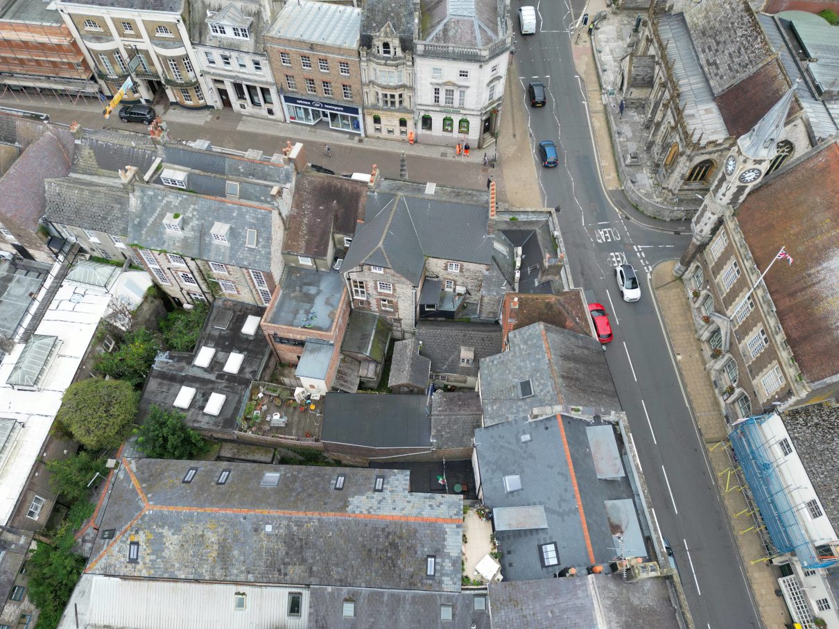
Drone Surveying and Inspection
Our drone surveying services leverage state-of-the-art unmanned aerial vehicles equipped with high-resolution cameras and sensors. We capture detailed aerial imagery and data to conduct surveys for land mapping, site monitoring, and environmental assessments. Our drone surveys deliver precise measurements and valuable insights to support project planning and decision-making.
Drone Inspections
Using drones for inspections offers a safe, efficient, and cost-effective alternative to traditional methods. Our UAVs can access hard-to-reach or hazardous areas, such as rooftops, towers, and industrial facilities, to visually assess structures and assets. We provide comprehensive inspection reports accompanied by high-resolution imagery, enabling our clients to identify issues and prioritize maintenance efforts with confidence.
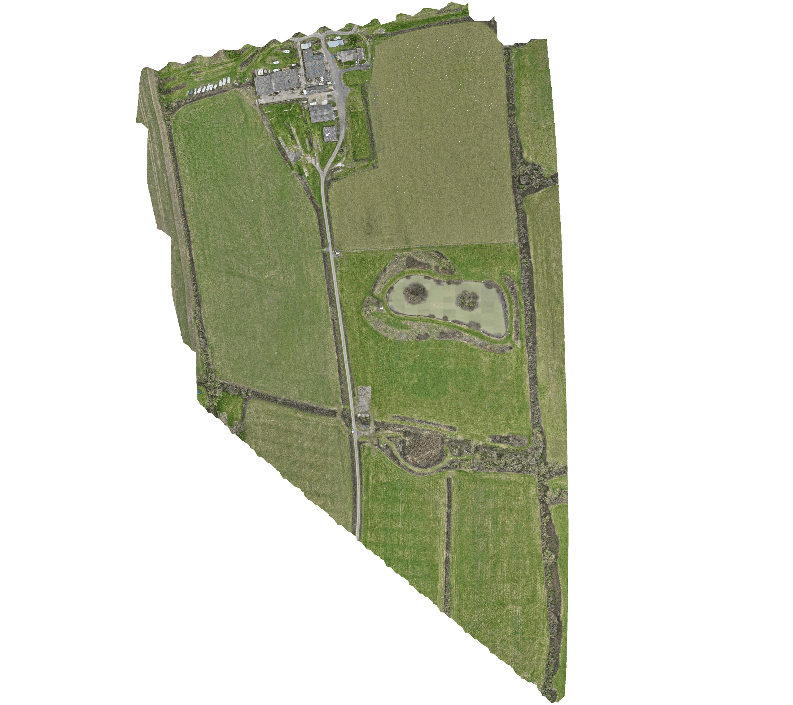
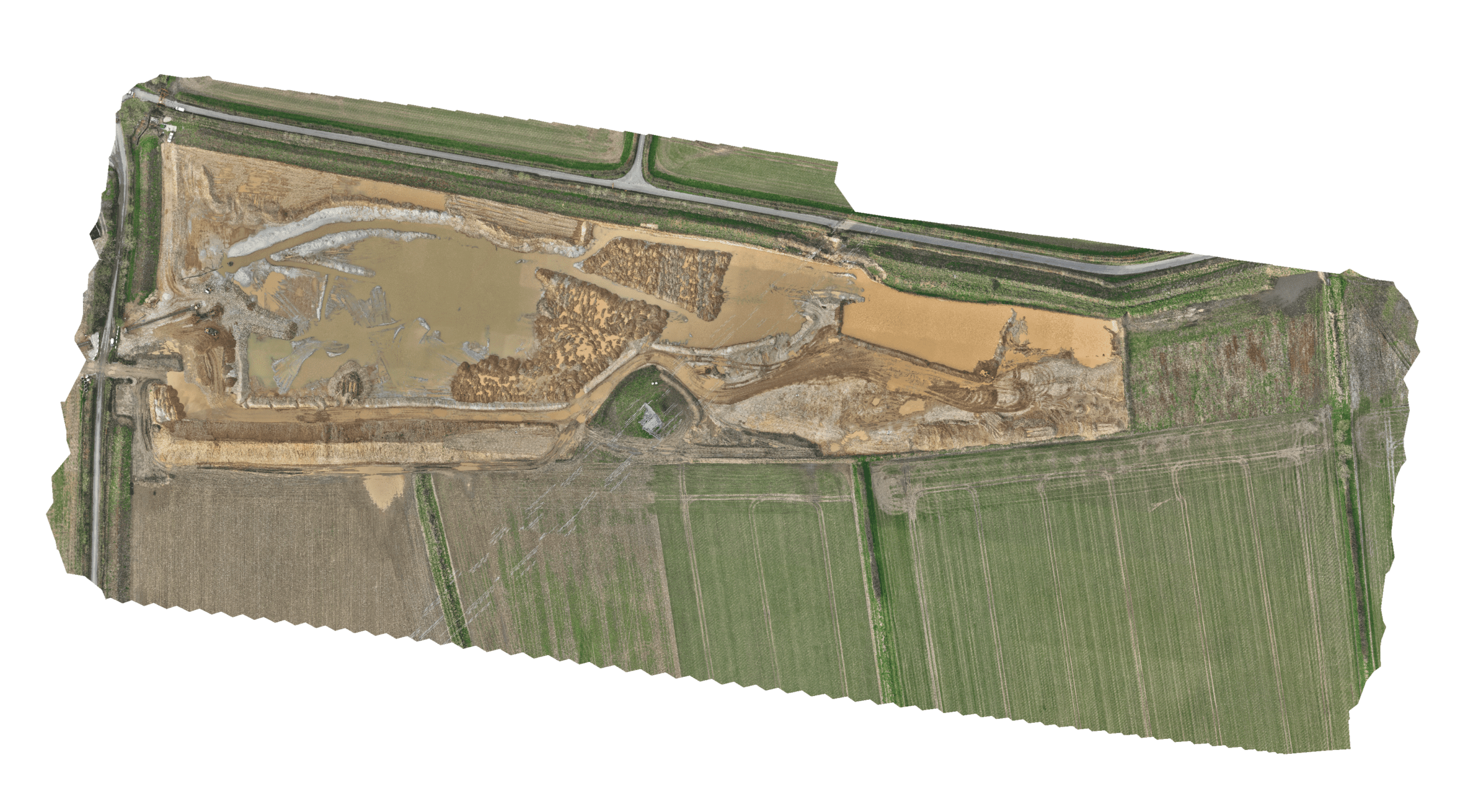
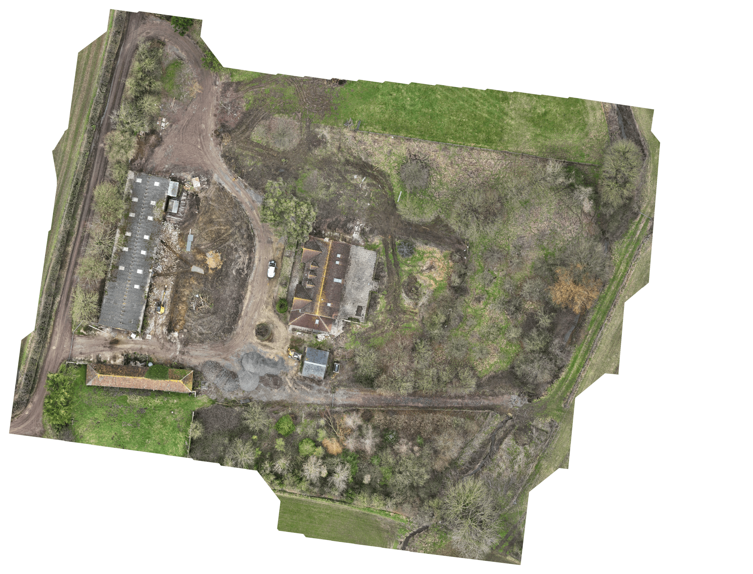
Photogrammetry Services
Through photogrammetric techniques, we create detailed 3D models of surveyed areas using aerial imagery captured by our drones. These models provide valuable visualization tools for urban planning, construction, and heritage preservation projects. Our photogrammetry services enhance spatial understanding and facilitate informed decision-making by providing accurate representations of terrain and features.

LiDAR Services
LiDAR technology enables us to capture precise measurements of surfaces and objects using laser pulses. With our LiDAR services, we generate highly detailed point clouds and 3D models for applications such as topographic mapping, infrastructure monitoring, and vegetation analysis. Our LiDAR capabilities provide unmatched accuracy and resolution for complex spatial data requirements.
Benefits of Our Services
- Accuracy and Precision: Our services deliver accurate and reliable data, ensuring confidence in decision-making processes.
- Efficiency and Time Savings: With rapid data collection and processing capabilities, we streamline workflows and minimize project timelines.
- Safety: By reducing the need for personnel to access hazardous or inaccessible areas, our services enhance safety and mitigate risk.
- Versatility: Our services are adaptable to a wide range of industries and applications, providing customized solutions to meet specific project requirements.
Contact Us Today
Experience the transformative potential of aerial technology with 4D Surveying Ltd. Whether you require surveying, inspections, photogrammetry, or LiDAR services, our expert team is dedicated to delivering innovative solutions tailored to your needs. Contact us today to learn more about how we can support your projects with efficiency, accuracy, and insight.